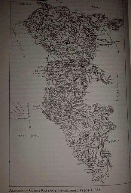
This is the map of the United Albania at the time of George Castriota, - Skanderbeg - 1403-1468. This map is made public by "nacional.com", without citing the source. Anyway, the deeds of Scanderbef are well known all over the world. In that sense can be presumed that this map has a high rate of verity.
As can be seen, the United Albania of Scanderbeg era comprised Kosovo, parts of today Serbia, about half of today Montenegro and Macedonia, Çamëria, including Ioannina, Zagoria and Kastoria - about 120,000 square kilometers. North was confined with Serbian Kingdom, Venice and Herzegovina, and South with Ottoman Empire.
The Illyrian era comprised almost all western Balkans, the Scanderbeg era about 120,000 square klm, and today only 28,000 klm.
Is the land of great philosophers, heroes and master minds. Is sad that Greece would have spoken Albanian today. Last century Greece Parliament voted for which language to speak - Albanian or Greece, and only for one vote, today in Greece is spoken Greek.


